As laid out in the European Commission’s Green Deal, Europe should become the first climate-neutral continent by 2050. The Green Deal’s main goals are to preserve biodiversity and reduce the effects of climate change and environmental pollution. Thanks to digitalisation, data is being collected and made available in more and more subject areas. This is happening to a large extent in many small decentralised networks. The complexity of environmental challenges often requires linking the different data types, which requires the development of intelligent tools at local and global level. Efficient linking of remote sensing data, sensor data (internet of things), socio-economic data and citizen science data can only be done if the data is available according to the FAIR principle. FAIR stands for "findable", "accessible", "interoperable" and "reusable".
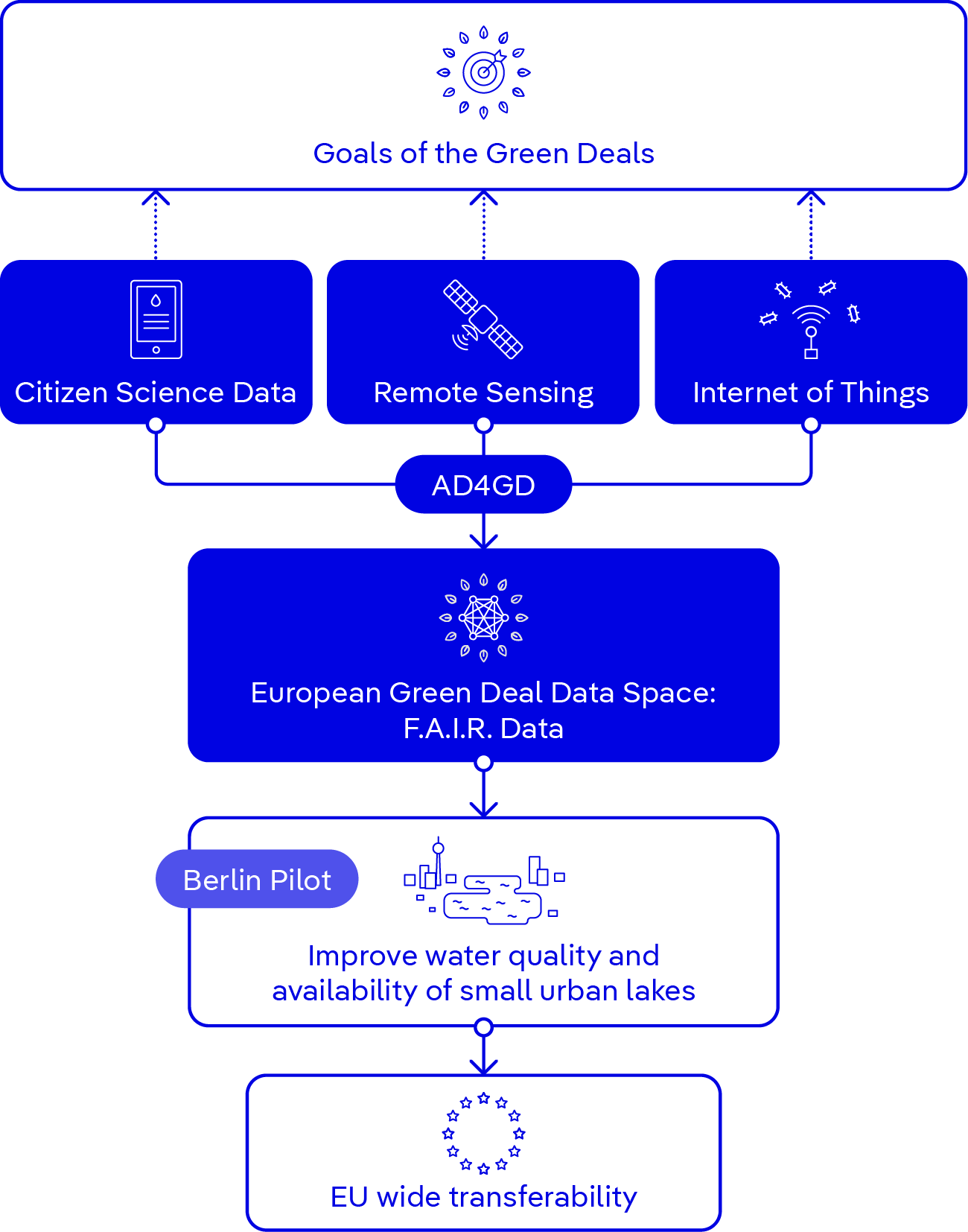
The AD4GD project will design a pan-European data space (Green Deal Data Space - GDDS) in which the different data types as well as data processing services will be available according to the FAIR principle. The focus is on interoperability concepts which bridge the semantic and technological gaps.
However, AD4GD is not a purely conceptual project. It is developing along three pilot projects on biodiversity, climate change and zero pollution, the latter of which is KWB’s responsibility. The pilot project is about the water quality and availability of small urban lakes in Berlin. According to the European Water Framework Directive, monitoring is not mandatory for lakes smaller than 50 hectares. Accordingly, little knowledge is usually available about these water bodies. In urban areas, however, they are important places for biodiversity and counteract heat islands. Water quality is significantly shaped by urban catchment areas. Water availability depends, among other things, on the degree of sealing of the surrounding urban area and the drainage system. KWB’s pilot project is about transferring knowledge about a few regularly sampled lakes to other water bodies to be able to respond to current and future challenges regarding water quality and availability. For example, we’re looking to answer questions about the extent to which rainwater runoff from urban areas can be used to prevent small lakes from drying out during dry periods, or how we can use satellite data to describe changes in the water quality of small lakes.
Requirements for the GDDS are derived from the handling of the data within the individual pilot projects. Within AD4GD, data and services will be made available to the European Commission's Knowledge Centres, the GEOSS portal, EOSC and other scientific services as appropriate. This ensures the sustainability of the results and access to the data space for research institutions, decision makers and the public.


